
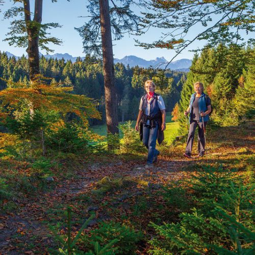
Walking in Lechbruck
These boots are made for walking
These boots are made for walking: everything from easy, intermediate to advanced levels available.
Interactive hiking map
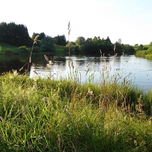
To the lake "Baderwaeldle"
A small moor lake, with its warm temperatures invites you to bathe and feel good. Even a walk there guarantees unforgettable nature experience.
Round trip
| Length: | 2,5 km |
| Max. climb: | 55 m |
| Duration: | 45 minutes |
Subsection from the holiday village to the lake
| Length: | 1,5 km |
| Duration: | 20 minutes |
Subsection from campingplace to the lake
| Length: | 1 km |
| Duration: | 12 minutes |
Lake "Baderwaeldle"
Starting point is the bridge. This route starts the same as the circular tour of the lake, but instead of going as far as the camping site turn off towards Clinic Koenigshof and keep to the left towards the holiday village “Hochbergle”. Here the road forks, keep to the right past the village, after a further left bend, head down the path to the small lake. Return either using the same route or via the forest trail leading towards the camping site and the main road.

To the Wies Church
The famous Rococo church is a very interesting destination for a small hike. Combine culture and nature.
Lechbruck - Steingaden
| Total length: | 6 km |
| Max. climb: | 40 m |
| Est. time required: | 1 ¼ hours |
Lechbruck - Wies
| Total Length: | 10,07 km |
| Max. climb: | 150 m |
| Est. time required: | 2 ½ hours |
Starting point is the bridge.
Cross the bridge and in Gründl turn right on to the road leading to Prem. After the first s-bend head towards Helmau and Karlsebene (2 farm houses). Continue along the north bank of the babbling brook towards Steingädele and then to Steingaden-Sandgraben. Having reached the outskirts of the village turn left along the main road B17 to the Raiffeisen bank and then turn right to the foot of a small hill. From here on follow the signposts Wies. Pass-by the small pond and Litzau to the Wies church.
Rehle-round tour
Enjoy different distances with a beautiful view of the Allgaeu mountains.
| Total length: | 7,5 km |
| Max. climb: | 130 m |
| Est. time required: | 1 ¾ hours |
Starting point: “Am Falchen”. Follow the road uphill until it ends at the Café Alpenblick. Continue straight ahead through the forest towards “Oberschlicht” and lake “Schmutter”. Before reaching Oberschlicht branch off to the left and pass through the meadows towards “Rehle”. Then head towards the road and Helmenstein. Turn right towards the dam. When you reach the dam turn left and head towards the river banking. Follow the trail back to Lechbruck.
To the lake Schmutter
A beautiful lake.
Passing cow pastures or walk through forest and meadows.
| Total length: | 4,4 km |
| Max. climb: | 90 m |
| Est. time required: | 1 ½ hours |
Starting point is “Am Falchen”.
Follow the road until you reach Cafe Alpenblick. Take the path straight ahead for a short while until the way goes off to the right though the forest then eventually back onto the path which leads to a farmyard “Oberschlicht” Pass-by the farm and follow the gravel path which leads down to the former railway-embankment (now only used by pedestrians and cyclists) just before you reach it, take a sharp turn left and head back up the hill. Just before reaching the lake’s reeds turn right and walk along the north bank of the lake passing the sunbathing lawns, until you reach the north-west end of the lake. From here you can go along the cycle path to the main road to Sameister and restaurant Aldler the birth house of Johann Jakob von Herkommer. If you do not wish to go the same way back to Lachbruck, then you can return via the cycle track.
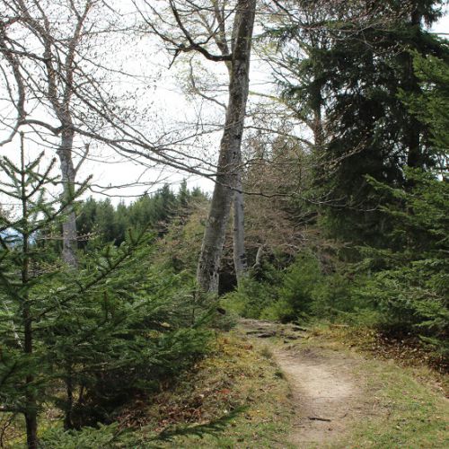
To the Auerberg
Follow Crispus up to the top of the Auerberg. On your way through the gorge "Auerberg" you pass seven adventure stations.
| Total length: | 8,4 km |
| Max. climb: | 385 m |
| Est. time required: | 2 ½ hours |
Starting point is the junction where “Brandach, “Pension Hirsch” and “Auerbergweg” meet.
Take the road (Auerbergweg) which forks off to the right and head up towards the golf course. After a short while turn right onto the “Panorama” route (entrance is the turnpike) passing Gsteig (golf driving range) to the south, from here continue straight on and keep to the right side of the wooden cross through the forest towards Ostermoos and then straight on to the village of Echerschwang. At the start of the village turn left towards the fire station. Turn left here down the road towards restaurant Lindauer. Take a right turn down a narrow path through the ditch and up the hill to Berk. Behind the first house turn left and then right at the barn and tree and go downhill to the wooden cross. Here it is possible to take a rest and enjoy the scenery. Head downwards towards the electricity pylon leaving Ober- and Unterlinden to your right. Take the gravel path to the left and cross over the brook to the farms “Angerhöfen”. Behind the farms turn left and head down a gravel road for approx. 300 m., cross over the brook again and turn right towards the wooden cross on the edge of the forest. Turn to the right and continue approx 300 m along the road to the foot of the hill (crossing Wiesbichl/Bürstenstiel and Wieshof). Take the barely noticeable road ahead of you up to the farm “Thalhof”, turn right and go up to the road which offer a fantastic view. Turn left and go through the village of Straß, passing the transformer building until you come to the isolated dairy. Turn a little bit to the right down a gravel path via a farm “Sonnhof” to Helmer. Behind the last farm take the lane westwards until you reach the lookout point and bench. Continue through the small wood until you reach the St. Georg church.

Muckenbichl round trip
Enjoy the untouched nature with all its enchanting charm.
Small tour
| Total length: | 2,5 km |
| Max. climb: | 20 m |
| Est. time required: | 40 minutes |
Long tour
| Total length: | 4 km |
| Max. climb: | 20 m |
| Est. time required: | 1 h |
Starting point is on the Lechwiesen Rd. opposite the foot bridge near the boats rental.
Follow this small side road for approx.. 400 m till you reach the pond. At the pond turn right and follow the path towards the holiday village. When you get to the parking lot turn right. Continue until you reach the barn, the path divides here and two routes are available. The one to the left takes you the long way round which is approx. 4 km long and straight ahead is the short route which is approx.. 2,5 km long. The longer route takes you via fields and meadows towards the small lake “Baderwaeldlesee” and along it’s shores back to the holiday village and your starting off point. The shorter route takes you round the lake and through a small forest to the holiday village and then back to your starting off point. Both routes can also begin at the holiday village.

Lechbrucker Picturesque Route
In the route you can always enjoy the splendid village and mountain panorama.
| Total length: | 2,9 km |
| Max. climb: | 60 m |
| Est. time required: | 50 minutes |
Starting point: Brandach, restaurant Hirsch (now closed to the public).
At the restaurant take the road which forks off to the right and head up towards the golf course. After a short while turn right into the Panorama route (entrance is the turnpike). Follow the path till Ostermoos then turn left at the farm and head downhill at the crossing turn left down the lane. Head back to the village.
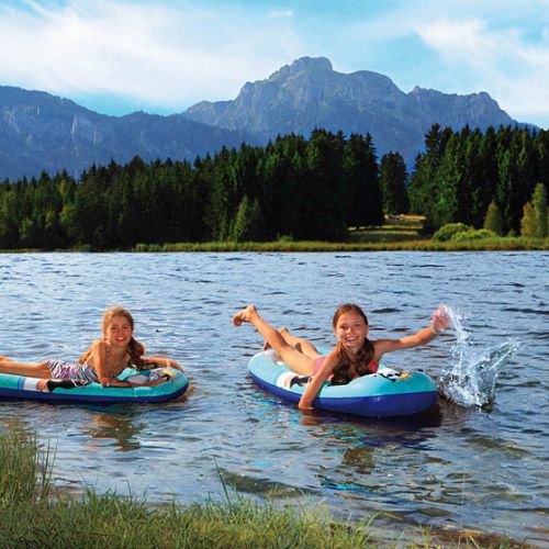
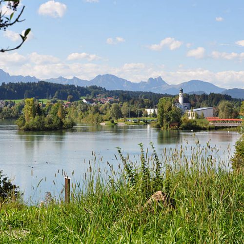
River Lech Circular Tour
Enjoy Flora and Fauna directly on the river Lech ans the wonderful Panorama that our incomparable landscape offers you.
| Total length: | 9 km |
| Max. climb: | 25 m |
| Est. time required: | 2 ¼ h |
Starting point is the „Lechbrücke“ (bridge).
This beautiful walk along the river Lech is 5,5 km long. Take the path on the east side of the bridge towards Gründl/Prem. After the S-bend turn left and follow the signs ( L). This route takes you through an interesting torf landscape. Here you must turn off to the right and follow the signs written “Moorlehrpfad. In Prem turn left and go through the village (please avoid going through the saw mill) heading towards the river embankment. After a short while you will reach a barbecue area which is situated near the Premer dam. Cross the dam and head down stream. You will pass a small lake to the east and eventually reach the toll-bar on Helmensteiner Road. This road will then lead you back to Lechbruck and the bridge where you started off from.
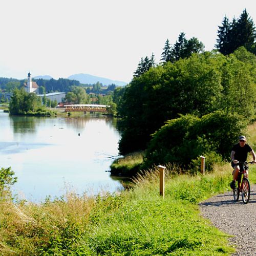
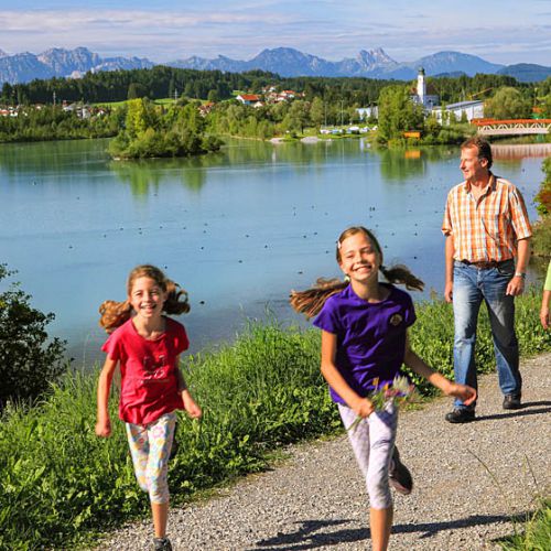
Lake Circular Tour
This way is suitable for the hole family. There ist exciting to discover for the children and the adults can relax in beautiful nature.
| Total length: | 8 km |
| Max. climb: | minimal |
| Est. time required: | 2 h |
Staring point is the bridge.
Take the path on the west side of the river heading down stream passing the rapids, Town Hall, children’s playground and adventure mini-golf course until you reach the small boats’ harbour. Follow the path, cross over the footbridge, turn right and head towards the camping site. On route there are various interactive elements for children, fitness machines and a kneipp facility. Just inside the camping-site, next to the restaurant (open to non-campers) there is a large children’s playground. Having passed the camping site (not through it), cross over the "Oberer Lechsee" dam. After joining the road turn right along a gravel path overlooking the lake which then gradually declines down to the southern embankment. This path leads to Gründl and the bridge – which was your starting point.
The path on our side of the river is also known as our “Adventure Trail”.
Lech Adventure Trail
Along the riverside you will pass different stations - a kneipp facility, sport facilities and much more. Game, fun and nature experiences for the hole family.
| Total length: | ca. 3 km |
| Max. climb: | minimal |
| Est. time required: | 30 minutes |
Staring point is the bridge. Take the path on the west side of the river heading down stream passing the rapids, Town Hall, children’s playground and adventure mini-golf course until you reach the small boats’ harbour. Follow the path, cross over the footbridge, turn right and head towards the camping site. On route there are various interactive elements for children, fitness machines and a kneipp facility. Just inside the camping-site, next to the restaurant (open to non-campers) there is a large children’s playground. Return to the village using the same path or continue and return via the other side of the lake. See Lake Cicular Tour for the description.